One-Week Forecast

  1. Current
    Fair 82°
    • 84°
    • 62°
    Fair
  2. Wed 08/05
    Mostly Cloudy
    • 84°
    • 68°
    Mostly Cloudy
  3. Thu 08/06
    Chance Rain Showers
    • 87°
    • 71°
    Chance Rain Showers
  4. Fri 08/07
    Chance Rain Showers
    • 89°
    • 71°
    Chance Rain Showers
  5. Sat 08/08
    Chance Rain Showers
    • 87°
    • 69°
    Chance Rain Showers
  6. Sun 08/09
    Slight Chance Rain Showers
    • 89°
    • 69°
    Slight Chance Rain Showers
  7. Mon 08/10
    Partly Sunny
    • 89°
    Partly Sunny
Cars Submerged, Thousands Lose Power As Flash Flooding Slams Connecticut Cars Submerged, Thousands Lose Power As Flash Flooding Slams Connecticut
Cars Submerged, Thousands Lose Power As Flash Flooding Slams Connecticut Heavy rain has flooded roads, knocked out power to thousands, and prompted a flash flood warning and tornado watch across parts of Connecticut as strong thunderstorms swept through the region Tuesday, July 21. The National Weather Service issued the flash flood warning for Fairfield County and western New Haven County. A tornado watch remains in effect for Fairfield, New Haven, and Litchfield counties until 9 p.m. Tuesday. Middlesex County remains under a flood advisory. Click here to see updated weather alerts across the state. Cars Submerged As Flooding Worsens Forecasters said between 1…
Snow Totals Are In: Here’s Which Greater Hartford Towns Got Hit The Hardest Snow Totals Are In: Here’s Which Greater Hartford Towns Got Hit The Hardest
Snow Totals Are In: Here’s Which Greater Hartford Towns Got Hit The Hardest The Northeast is digging out, and the snow totals are in. By 1 a.m. Monday, Jan. 26, the National Weather Service issued updated storm-total snowfall reports across New Jersey, New York, and Connecticut as the system wrapped up. Many communities finished in the double digits, with the highest totals pushing past 17 inches in parts of the region, according to the National Weather Service. Connecticut FAIRFIELD COUNTY New Fairfield: 16.0 in at 10:09 p.m. Bethel: 15.7 in at 10:27 p.m. Danbury: 15.5 in at 10:45 p.m. Bridgeport Airport: 15.1 in at 12:00 a.m. Greenwich: 11.0 in at 6:38 p.m. N…
As 10-18 Inches Of Snow Heads To CT, State Leaders Issue Stern Warning: 'Stay Home' As 10-18 Inches Of Snow Heads To CT, State Leaders Issue Stern Warning: 'Stay Home'
As 10-18 Inches Of Snow Heads To CT, State Leaders Issue Stern Warning: 'Stay Home' State leaders are urging residents to stay home as a major snowstorm and brutal cold move into Connecticut. “We are strongly urging everyone to make plans in advance to avoid all unnecessary travel on Sunday,” Gov. Ned Lamont said. “Our state snowplow fleet is prepared to clear the roads, and the fewer cars out there, the quicker and safer the snowplow crews can do their work.” Snow is expected to begin mid to late morning Sunday, Jan. 25, and the state could see between 10 and 18 inches of snow by Monday, depending on the region.  The Connecticut Department of Transportation said abo…
Final Post-Christmas Storm Update: These Locations In CT, Region Saw Most Snowfall Final Post-Christmas Storm Update: These Locations In CT, Region Saw Most Snowfall
Final Post-Christmas Storm Update: These Locations In CT, Region Saw Most Snowfall Here's a newly updated rundown of snowfall accumulation reports compiled by the National Weather Service for the winter storm that arrived late Friday afternoon, Dec. 26, and lasted until Monday morning, Dec. 27.  The highest reported totals of 9-10 inches of accumulation came mainly from the Hudson Valley and northwestern Connecticut. Related story - Second Storm In Days Will Bring Heavy Rain, Icy Mix, Gusty Winds To Northeast: Here's Timing New York Manhattan Central Park 4.3 in 0700 AM 12/27 Official NWS Obs Bronx NNE Fordham 4.3 in 0400 AM 12/27 Public Brooklyn…
Storm Could Dump Foot Of Snow; CT Gov. Lamont Urges Drivers To Stay Off Roads Storm Could Dump Foot Of Snow; CT Gov. Lamont Urges Drivers To Stay Off Roads
Storm Could Dump Foot Of Snow; CT Gov. Lamont Urges Drivers To Stay Off Roads As a powerful snowstorm pummels Connecticut, Gov. Ned Lamont is asking people to stay off the roads unless it's necessary.  Lamont issued the warning on Friday, Dec. 26, the same day weather forecasters predicted between six inches and up to a foot of snow to fall across Connecticut. The state remains under a winter storm warning until Saturday morning.  While most of the state is being hit with flurries, conditions are expected to worsen between 5 p.m. and 8 p.m. Snowfall rates could top two inches per hour. Total accumulations may reach 6 to 12 inches by the time it tapers off n…
High Winds Leave Thousands Without Power Across CT High Winds Leave Thousands Without Power Across CT
High Winds Leave Thousands Without Power Across CT Strong winds and heavy rain knocked out power to thousands of Connecticut homes Friday as a powerful storm moved across the state. More than 50,000 customers were without electricity by midday, according to Eversource and United Illuminating. Outages spread quickly as conditions worsened. Dangerous winds were expected to continue battering much of the state through the afternoon, according to the National Weather Service. Meteorologists warn that wind gusts could reach up to 50 miles per hour. Eversource said it dispatched crews statewide to repair damaged power lines and restore electric…
3 CT Counties Now In Stage 2 Drought, Gov. Lamont Says: What That Means For Rest Of State 3 CT Counties Now In Stage 2 Drought, Gov. Lamont Says: What That Means For Rest Of State
3 CT Counties Now In Stage 2 Drought, Gov. Lamont Says: What That Means For Rest Of State Governor Ned Lamont has declared a Stage 2 drought advisory for Fairfield, Middlesex, and New Haven counties as rainfall levels continue to drop across Connecticut. A Stage 2 drought marks an “emerging drought event” that could affect drinking water, farms, and the environment. It is the second of five stages under the state’s drought plan. Stage 5 is the most extreme.  The state is asking residents and businesses to conserve water by shutting off automatic sprinklers, fixing leaky faucets, and following local conservation requests. Officials also warn that those relying on private we…
New Update: Here Are Final, Updated Snowfall Totals For Connecticut New Update: Here Are Final, Updated Snowfall Totals For Connecticut
New Update: Here Are Final, Updated Snowfall Totals For Connecticut Here's a look at snowfall accumulation totals from Connecticut and Massachusetts compiled by the National Weather Service for the storm that moved through Saturday night, Feb. 8 into Sunday, Feb. 9. Location Amount Time/Date Provider Connecticut Fairfield County Sandy Hook 6.1 inches 0900 AM 02/09 COCORAHS Bridgeport Airport 5.0 inches 0700 AM 02/09 Official NWS Obs 1 E Danbury 5.0 inches 0700 AM 02/09 Trained Spotter New Canaan 5.0 inches 0800 AM 02/09 COCORAHS Newtown 5.3 S 5.0 inches 084…
These Towns Got The Most Snow In CT: Winter Storm Brings 6 Inches Across The State These Towns Got The Most Snow In CT: Winter Storm Brings 6 Inches Across The State
These Towns Got The Most Snow In CT: Winter Storm Brings 6 Inches Across The State Connecticut towns experienced significant snowfall from the storm that swept through the region on Jan. 19 and 20.  Towns in Hartford County recorded some of the highest totals in the state, with North Canton and Glastonbury Center each receiving 6 inches, according to the National Weather Service. Other counties, including Fairfield and Tolland, also saw substantial snow, with several towns reporting over 5 inches. Alongside North Canton and Glastonbury Center's 6-inch totals, towns such as Bristol and Bradley Airport reported over 5 inches of snow. Simsbury, East Hartford, and South …
2 Inches Of Snow Could Fall This Weekend Across CT: Here's Your Forecast 2 Inches Of Snow Could Fall This Weekend Across CT: Here's Your Forecast
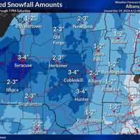
2 Inches Of Snow Could Fall This Weekend Across CT: Here's Your Forecast A winter storm is poised to bring light to moderate snowfall to eastern New York, western Massachusetts, and parts of Connecticut from Friday morning, Dec. 20 through Saturday evening, Dec. 21, according to the National Weather Service. A Hazardous Weather Outlook has been issued for the region, warning of slippery travel conditions, particularly during the Friday evening commute. While snowfall amounts are expected to remain below advisory levels—less than 4 inches—hazardous road conditions are likely. Thursday will be partly sunny with a high near 39°F and northwest winds of 7 to 10 mph, …
Snow, Wintry Mix Delays CT School Openings: Here's Where Snow, Wintry Mix Delays CT School Openings: Here's Where
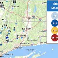
Snow, Wintry Mix Delays CT School Openings: Here's Where Dozens of schools across Connecticut had delayed openings due to a wintry mix that fell into Monday morning, Dec. 16. Some parts of the state saw 4 inches of snow, while others got a light dusting. According to the National Weather Service, the highest amount of snow fell in New Milford (4 inches); Cornwall saw 2.5 inches; Litchfield saw two inches, Waterbury saw 3 inches; Meriden saw 2 inches, and Hartford saw 1.3 inches. According to NBC Connecticut, the following districts had delayed openings: Berlin Public Schools Bethel Public Schools Brooklyn Public Schools Canton Public Schools E…
2 Tornadoes Confirmed In NY This Week: Here's When, Where 2 Tornadoes Confirmed In NY This Week: Here's When, Where
2 Tornadoes Confirmed In NY This Week: Here's When, Where A pair of new tornadoes have been confirmed in New York this week. Both occurred upstate on Wednesday, July 24, and they come after 10 twisters hit central and northern New York last week. In Oswego County, the first tornado on Wednesday touched down just before 3:30 p.m. in the town of Orwell, about 40 miles north of Syracuse. It left a short, coherent path of broken tree limbs extended down an east-west path and had peak winds of 85 miles per hour, ranking it as an EF-0 tornado, the weakest of six levels on the Enhanced Fujita Scale, according to the National Weather Service. The o…
Tornado May Have Touched Down In Hudson Valley During Round Of Severe Storms Tornado May Have Touched Down In Hudson Valley During Round Of Severe Storms
Tornado May Have Touched Down In Hudson Valley During Round Of Severe Storms An investigation is underway to determine if a tornado touched down in the Hudson Valley during a round of severe storms on Thursday, May 23. The probe is focusing on the Orange County village of Greenwood Lake. Starting at around 7:20 a.m., a total of 34 calls were received reporting various issues related to the storm such as downed trees and power lines, alarm activations, vehicle rescues, gas leaks, structural damage reports and other fire type call, according to Orange County Emergency Services. The department said it is working with the National Weather Service to identify …